Hyderabad - A View from the Air
Ever figured out why there are so few photographs of how Hyderabad looks from the
air - thats because the indian government used to prevent carraige of cameras and
photographic material in scheduled and non scheduled flights. From Dec 2004, all that is
changed and the govt allowed photography from normal civilian flights
I got my oppurtunity on February 8th, on an Air Deccan Flight to Bangalore. It was the ideal flight, the ATR42, a prop driven commuter style aircraft flies low and slow, allowing one to capture the sights and sounds. The aircraft took off from Begumpet facing east - and it gained height over Secunderabad, took a turn near Moulalai, flew over Tarnaka , Osmania University and Nadirgul airfield. These pictures are the result of the frantic clicking I did during those brief moments.
 |
Begumpet Old Airport ATC. Now being used by the IAF. |
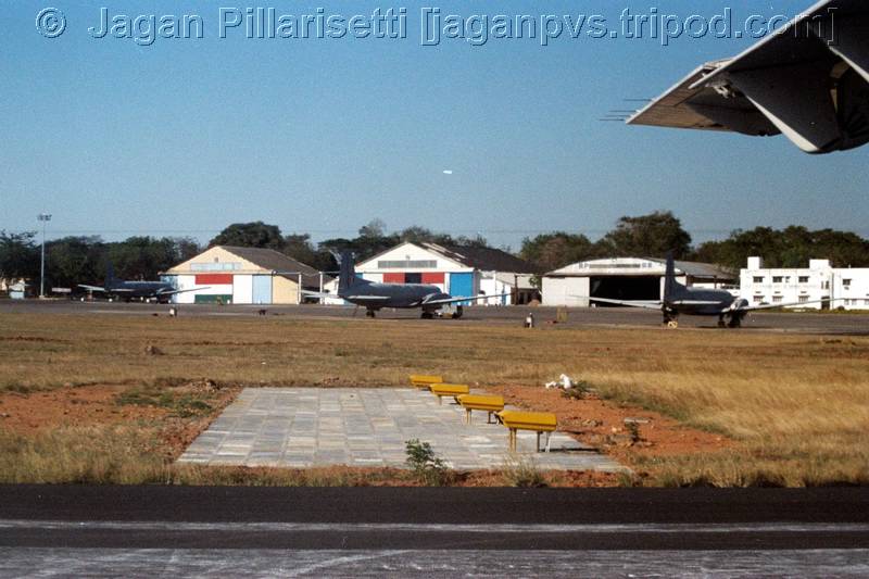 |
IAF HS748s parked on the Apron |
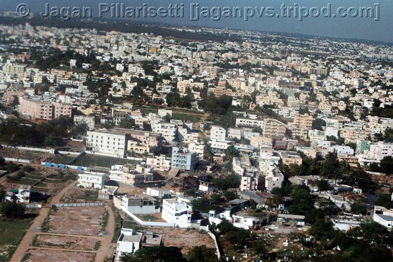 |
This is a shot of Secunderabad from the Air looking North. I have not been
able to find out which location this is.. |
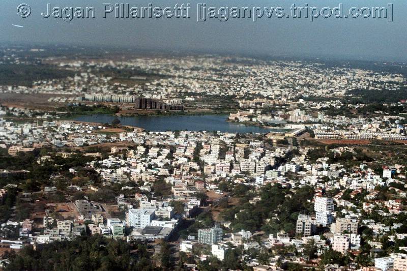 |
This another picture further down. That lake is a surprise - I assume its at Safilguda / Malkajgiri. The Road in bottom center will help us find out. |
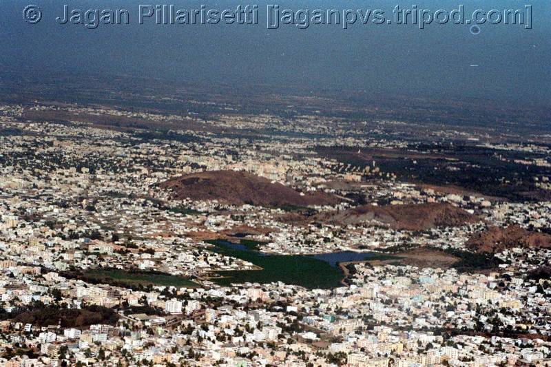 |
The Hillock in the center is definitely the Moula-Ali hill - ECIL X Roads would like behind it. |
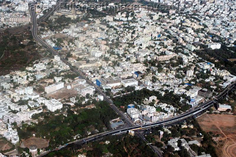 |
This is an easy one - Tarnaka. The flyover from Secbad to Uppal can be
seen, as is the APSRTC Hospital at the bottom of the frame. Aradhana Theatre at lower
right, and the 'A' Grounds of OU. Further to the top left is the Tarnaka flyover that goes to ECIL X Roads. This is one great picture! |
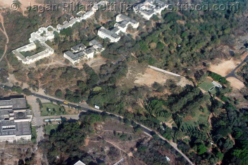 |
The ATR-42 is now flying directly over Osmania University. The Arts College building is prominent (bottom Left). The Osmania Unversity Library corner can just be seen in the bottom. the other OU Park dominates most of the picture |
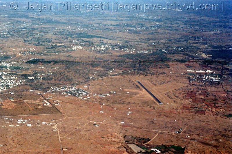 |
Nadirgul airfield to the southwest of Hyderabad. Its a surprise to find a paved runway at this place. |
 |
Nadirgul airfield again. |